


Remote Sens. 2023, 15(16), 3934; https://doi.org/10.3390/rs15163934 - 08 Aug 2023
Abstract
The implementation of precise agricultural fields can drive the intelligent development of agricultural production, and high-resolution remote sensing images provide convenience for obtaining precise fields. With the advancement of spatial resolution, the complexity and heterogeneity of land features are accentuated, making it challenging
[...] Read more.
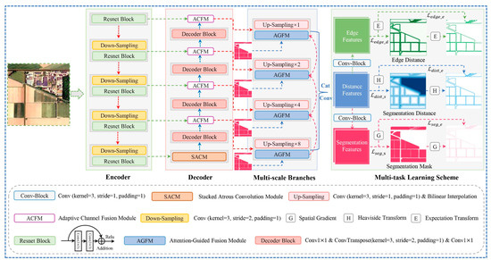
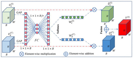
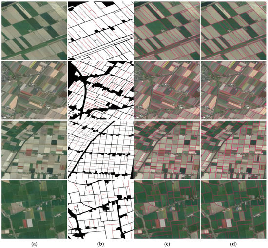
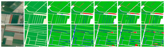
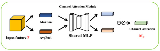
The implementation of precise agricultural fields can drive the intelligent development of agricultural production, and high-resolution remote sensing images provide convenience for obtaining precise fields. With the advancement of spatial resolution, the complexity and heterogeneity of land features are accentuated, making it challenging for existing methods to obtain structurally complete fields, especially in regions with blurred edges. Therefore, a multi-task learning network with attention-guided mechanism is introduced for segmenting agricultural fields. To be more specific, the attention-guided fusion module is used to learn complementary information layer by layer, while the multi-task learning scheme considers both edge detection and semantic segmentation task. Based on this, we further segmented the merged fields using broken edges, following the theory of connectivity perception. Finally, we chose three cities in The Netherlands as study areas for experimentation, and evaluated the extracted field regions and edges separately, the results showed that (1) The proposed method achieved the highest accuracy in three cities, with IoU of 91.27%, 93.05% and 89.76%, respectively. (2) The Qua metrics of the processed edges demonstrated improvements of 6%, 6%, and 5%, respectively. This work successfully segmented potential fields with blurred edges, indicating its potential for precision agriculture development.
Full article
(This article belongs to the Special Issue Remote Sensing and Associated Artificial Intelligence in Agricultural Applications)
►
Show Figures

Figure 1


