


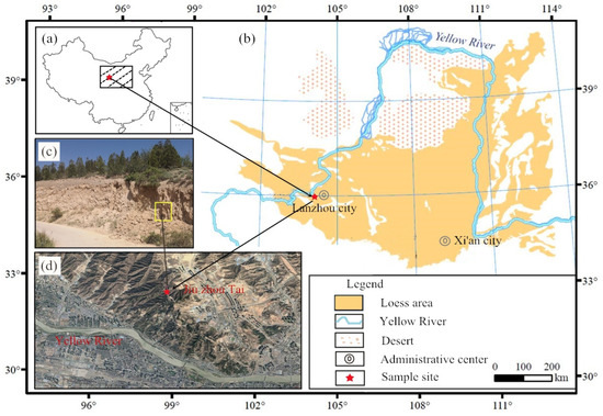
.png)

Water 2023, 15(16), 2868; https://doi.org/10.3390/w15162868 - 08 Aug 2023
Abstract
Water is the most important resource for human, animal, and vegetal life. Recently, the use of artificial intelligence techniques, such as Random Forest, has been combined with other techniques, such as models of logical–mathematical reasoning, to generate predictive water quality models. In this
[...] Read more.
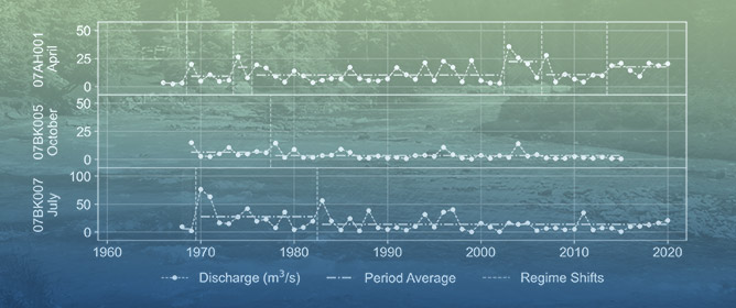
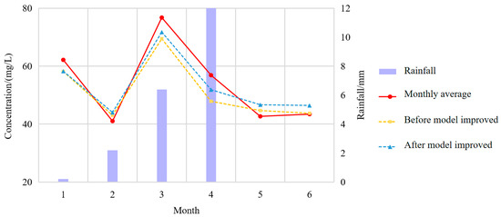
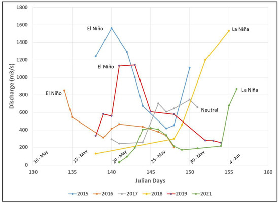
Water is the most important resource for human, animal, and vegetal life. Recently, the use of artificial intelligence techniques, such as Random Forest, has been combined with other techniques, such as models of logical–mathematical reasoning, to generate predictive water quality models. In this study, a rule-based inference technique to generate water quality labels is described, using historical physicochemical parameter data on seven water monitoring stations in Loa River, collected by the Chilean Ministry of the Environment. Next, a predictive model of water quality status was created, using Random Forest, physicochemical parameters, and expert knowledge. The validation of Random Forest results is described using three quality indicators from the machine learning model: accuracy (acc), precision (p), and recall (r). This paper describes dataset preparation, the refinement of the threshold values used for the physicochemical parameters most significant in the class, and the predictive model labeling water quality. The models obtained yielded the following mean values: acc = 0.897, p = 89.73, and r = 0.928. The ML model reported here is novel since no previous studies of this kind predict the water quality of Loa River, located in an extremely arid zone. This study also helps to create specific knowledge to predict freshwater quality.
Full article
(This article belongs to the Section New Sensors, New Technologies and Machine Learning in Water Sciences)
►
Show Figures
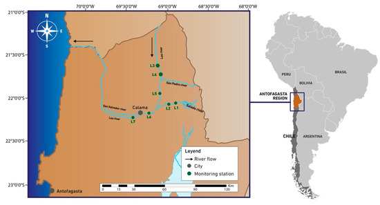
Figure 1


